The Five Corners Run 2010

This year, we will be traveling along the borders of the United States; from southern California to Brownsville, Texas- to Key West, Florida to the northern border of Maine- across the Great Lakes into Canada, to northwestern Washington, and finally back home.

12,000 miles - 30 states - 3 countries.

We call our little jaunt the Five Corners Run…

___________________________________________________________

"Life's journey is not to arrive at the grave safely, in a well preserved body, but rather to skid in sideways, totally worn out, shouting 'Holy shit, what a ride!'"

~ Mavis Leyrer
___________________________________________________________

Friday, July 16, 2010

Final Reflections


Our trip took us almost 13,000 miles. We talked to hundreds of people along the way, rode through some 30 states, and saw things on a daily basis that the average American will never see. You can't see America from an airplane, or sitting in a car while driving down an interstate. You can't meet Americans from the seat of a plane at 30,000 feet.  At least for the time being, America is accessible to anyone, but it doesn't come to you. You can't learn anything about Americans by watching movies or listening to the main stream, liberal media. You have to go to them, and approach them, and listen to them. Americans have a lot to say about what is happening in our country today, but nobody is really listening to them. Americans love their country. They love and respect their flag. They are a religious, steady group who go to work every day, raise their families, teach their children the difference between right and wrong, and continue to have what many believe are old fashioned ideas and values. They truly understand what is happening in America today. They believe in our founders, and they believe in our constitution, and they believe in the rule of law. They are not racists, or homophobes, or radicals, or revolutionaries. But they understand there are those seeking to change our way of wife, not to merely move "to the left," but to fundamentally change our society into a socialist country, part of a utopian "global" society where America will come to a quiet end. They know how it is going to effect them and their children in the future.

We started out to find and meet these Americans and learn from them. It was a wonderful, fulfilling experience for us all.

 
GOD BLESS AMERICA.

Thursday, July 15, 2010

Home

Day: 58
Destination: Home, via the Golden Gate Bridge, and the Buena Vista
Route: Highway 1, then Highway 101
Miles Ridden: 228     Total Miles: 12,954

Points of Interest:
  • Stewart's Point
  • Northern SF Bay
  • Golden Gate Bridge
  • Home with our loved ones and friends

We knew we had quite a ride ahead of us today. It was tempting to stay on Highway 101, and be home in four hours. But we had a goal in the beginning, and that goal was to ride, to the extent possible, the perimeter of the entire United States. That meant, of course, small, two lane roads most of the time, since major highways rarely have been built on the perimeter of the US.
 
Tempting as it was, we stayed on the roads closest to the Pacific Ocean, which meant Highway 1. Another day of rolling hills and twisties, over 100 miles of them, meant the ride would be pleasant but slow. We estimated we would be home by 3:00 p.m., leaving at 8:00 a.m. It became evident we would have to skip lunch if we were going to be close, and we just kept moving. Most of Highway 1 at this location is a very narrow road, with few cars, but well worth taking. For us, it ended near Sausalito where it merged with Highway 101. We went a few miles, and exited just before the Golden Gate Bridge. We climbed the hill, and found a scenic point just above the Golden Gate. We had begun the trip on the south side of the bridge, and it was only fitting we would "close the loop" on the north side. We took the time to talk to many visitors to California, who were there to photograph the bridge from that vantage point. We took our photos, and then crossed the bridge into San Francisco. We stopped by the Buena Vista, a bar famous for creating the Irish Coffee, and then headed home.
 
 
When we arrived in Danville, we were greeted by many of our friends and family who were there to congratulate us for completing our journey. It was great to see them, to be home, and great to have those hugs and kisses from our wives. Journey's end. One of our dreams had come true!

Wednesday, July 14, 2010

Mendocino

Day: 57
Destination: Mendocino, California
Route: 101 South to Leggett, CA; Highway 1 South
Miles Ridden: 150    Total Miles: 12,726

Points of Interest:
  • Avenue of the Giants
  • Mendocino, California
  • Patterson's Restaurant

With only 150 miles to ride from Eureka and Mendocino, we relaxed a little, and didn't leave until 10:00 a.m. A little chilly, but clear, we put on our jackets and started heading south. Our goal was ride the Avenue of Giants, just south of Eureka. If you haven't taken this ride, it is a must for anyone in the area. The Avenue runs for several miles, and runs parallel with Highway 101. There are seven exits and entrances off of 101 to the Avenue, so you can ride all or part of the Avenue. The Avenue runs through several small communities, and past yet another sign of better economic times. We passed a very large lumber mill which, like the eight in Montana, employed hundreds but were shut down by the environmentalists. We passed through several stands of the most beautiful, enormous redwood trees imaginable. The tallest and oldest living thing on earth is in one of the groves of trees, although which tree has never been publicly disclosed. We stopped a few times, and found an enormous field of clover amongst the redwoods. Fantastic experience of which you just cannot grow tired.
 
Through the Avenue, we jumped on Highway 101. Forty miles later, we made the turn onto Highway 1 at Leggett. This 35 miles or so of twisted, rolling hills, with numerous 10 and 15 mph turns, also runs through the redwoods and is a great run. Eventually, you pass a sign which says "Shoreline Highway." You think the road will straighten, but noooo. More twisties as you make your way to Fort Bragg and, a mere 10 or so miles later, Mendocino. Today remained cool, and fingers of fog extended into the forests and surrounded many of the coves and inlets. Pretty much everything had a gray overcast, but the Pacific Ocean was beautiful, and the ride great. Mendocino is a very small, tourist community loaded with beds and breakfast, restaurants, and a handful of bars. We found a small, local establishment, had a very nice meal, and looked forward to tomorrow's ride home.

Ahead of schedule

The guys are running two days ahead of schedule, and due to return to their starting place of Starbucks in Danville, CA on Thursday, July 15, 2010 at 3:00 P.M.!

Tuesday, July 13, 2010

Trinidad and Eureka

Day: 56
Destination: Trinidad, then Eureka, California
Miles Ridden: 204 Total Miles: 12,576
Route: Highway 101 South
Points of Interest:
  • Scenic view from Port Orford
  • State and federal forests and parks to the Oregon border
  • National Redwood Park, California
  • Trinidad wharf

We were on the road at 8:30 a.m. today on our way to Trinidad, California. It was clear and sunny, but we could see fog to our north, and the forecast was for cooler weather, fog, and 35 mph winds from the north. On came the jackets, and we began our journey. It became apparent, however, that jackets alone would not be enough. Within a couple miles, we began hitting fog banks stretching across the highway. Each time, the temperature would drop dramatically, only to rise again when we hit sunshine rather than fog. We stopped at Port Orford, a small town, for fuel. When we began to leave, we saw a painted sign on the pavement of a side street, pointing in the direction of the "Ocean View." We took the road and found a tiled bench setting high on a bluff above a cove and beach below.


The Oregon coastline is beautiful, but it is very rugged and rocky. We were told that whales were visible from this vantage the day before, but today we did not see any whales, although the view was great. We took a few pictures, and we were off again. We rode through the redwoods of California. Not our first time, but the giant redwoods are always impressive.


We arrived at Trinidad, which is a very small town 20 miles north of Eureka. The small road curls west from the freeway, and makes its way down the hillside to the ocean and cove. We ate at a great restaurant at the end of the road, and took in the great view. We then made our way to Eureka, a much larger town, with the problems you would expect to find in any larger city. We found the Red Lion, had a snack while watching the All Star game, and settled in for the evening.

Monday, July 12, 2010

Bandon (Day 2)

Day: 55

Destination: Bandon, Oregon (Day 2)
Miles Ridden: 10    Total Miles: 12,372

Points of Interest:
  • Bandon golf resort (Old MacDonald Golf Links course)
  • The Loft Restaurant

Proving once again that you can do it all, we played golf today at the Old MacDonald Golf Links, the newest of the four courses at the resort.

As we rode to the course, the fog began pulling away. The skies were crystal blue and without a cloud in the sky. The course began to warm, but very strong winds coming off the Pacific kept the temperature in the high 60's. The strong and constant winds made the game interesting, but we had a great time. Later, we met for dinner at the Loft in Old Town. The dinner and service was excellent, and I would recommend it to anyone who may visit Bandon.

Sunday, July 11, 2010

Bandon

Day: 54
Destination: Bandon, Oregon
Route: Highway 5 south; 99 south; 240 west; forest service road between Carlton and Beaver; south on 101
Miles Ridden: 284     Total Miles: 12,362

Points of Interest:
  • Forest service road over the Coast Ranges
  • Bald Peak State Park
  • Suislaw National Forest
  • Numerous coastal state parks
  • Sea Lion Caves
  • Oregon Dunes National Recreation Area
  • Old Town Bandon, Oregon 

Another beautiful day for a ride. We rode out of Portland, and began heading southwest towards the Pacific Coast. For the first 50 miles, we rode over the Coastal Ranges on single and two lane roads, through forests and over bridges, reaching summits which looked into the valleys below. Due to the hour of the day, we hit areas brightly lit from the sun, other areas shrouded in shade so that the roadway was barely visible. At one point, a deer suddenly ran across the road about 20 feet in front of Bud's bike. Moose, Elk, Antelope and Deer...they all like to run in front of or alongside Bud. The ride over the range was rather slow, but we ultimately reached Highway 101, and turned south towards Bandon. The coast was much colder than inland, and jackets became a necessity. We began to hit areas covered with fog, which made for some nice photo opportunities. We arrived at Bandon about 5:30 p.m.

Bandon is a nice little town best known for its port in Old Town, and the Bandon Dunes golf resort to the north. We were there for both. Old Town, as it is called, has several nice shops and numerous good restaurants. We choose one, had dinner, and then settled in for the night.

Saturday, July 10, 2010

Portland

Day: 53
Destination: Portland, Oregon
Route: Highway 101 south; Highway 4 south to 401; Astoria Bridge to Astoria; Highway 30 to Portland
Miles Ridden: 211   Total Miles: 12,073

Points of Interest:
  • Grays Harbor
  • Willapa Bay
  • Lewis and Clark Trail, Park
  • Astoria, Oregon

As we left Aberdeen, driving through the small towns on our way to Portland, we drove past homes, businesses, buildings, factories and docks evidencing former prosperity, but now providing further evidence of a collapsing American economy. It was sad to see, but an unfortunate confirmation of what most Americans already know.

Once we got through these towns, we began our ride south through forests and state parks. The ride was very nice. There were several reminders that this route was first discovered by Lewis and Clark during their famous exploration between Missouri and the Oregon coastline. As we rounded the bend approaching the Pacific, we could see the Astoria Bridge, which spans Chinook with Astoria. It is a long, old bridge which, at its southern end, rises high above the city below. As you arrive in Astoria, a city founded around 1800, you see small homes built up the hillside. We saw the Flavel House Museum, built for a sea captain in 1885, and the former county jail, built in 1914. After having a great lunch, and Mikie Three Meals buying some salmon from Josephson's Smoked Fish, we rode through town on Highway 30 to Portland, Oregon. On the way, we had some great views of Mount St. Helen and Mount Hood. A nice ride. Dinner at PF Changs, a couple cocktails at Henry's downtown, and life was good.

Friday, July 9, 2010

Aberdeen

Day: 52


Destination: Aberdeen, Washington
Route: Highway 5 south to Highway 20; west on 20 to the Port Townsend Ferry; Highway 1 west, south
Miles Ridden: 288   Total Miles: 11,863

Points of Interest:
  • Deception Pass State Park
  • Port Townsend Ferry ride
  • Olympic National Park
  • Olympic National Forest

Having our primary goal accomplished after all these weeks, we began our ride home. We still have a second goal, and that was and is to ride the perimeter of the United States. We rode to the island which separates Burlington and Port Townsend, and took the ferry. This permitted us to relax for an hour while the ferry casually crossed the Strait of Juan de Fuca. The water was cold and deep, and was the bluest water I have seen. When the ferry docked, we saw the Rothschild House, a stone structure which sets high on a bluff over looking the strait. We stopped in the historic district and took a few pics. The historic district was built in the 1880's, and the stone and brick buildings were beautiful. We enjoyed a great meal of clam chowder and crab cakes, and feeling pretty good but struggling to stay awake, we headed towards Highway 101, Port Angeles, and towards the national park and forest.
 
The ride through the forest, with glimpses of the strait and other waterways, was absolutely beautiful. The traffic was light for the most part, and the road was in great condition. The best way to describe the road is rolling with twisties through the park, and with high speed twisties on the south end of the park. A rather long day, but a great day! And...one day closer to home and our loved ones.

Mission Accomplished!

Mission accomplished...on July 8, 2010, we arrived at the fifth corner of the United States, the Peace Arch which sets between the United States and Canada at the extreme northwest corner of Washington State.

Now, one might ask how we were able to be photographed at the Peace Arch, which sets in a "DMZ" area between the United States immigration and custom office and the Canadian immigration and custom office.

We were looking for the arch, and went to a new, beautiful US custom and immigration office. We couldn't find the arch, but found a great guy who will only be identified as a "worker" at the new facility. He explained that the building was still under construction. He also told us that nobody could actually get to the Peace Arch, since it sat in this DMZ area, actually setting on the line between the US and Canada. It was not in a park, and not generally accessible to the public. We explained our purpose in finding a suitable place for our dance and photos. When he learned of our trip, he had a solution...a GREAT solution. He took us into a construction trailer, and had us wear hard hats and safety vests. He said they had been working at the site for two years, and that "nobody will notice." He then guided us onto the highway leading into the existing US customs facility, over the new customs and immigration building, and down into the area between the US and Canada where the Peace Arch was located. He then actually took our photos in front of the arch, and even took the video of our "Five Corners Dance." If you look at the photos above, note the hard hats and safety vests. A nice addition to our motorcycle garb. Many, many thanks to our new friend at immigration!

Thursday, July 8, 2010

Blaine

Day: 51
Destination: Blaine, WA
Route: Highway 97 Alt west; Highway 197; Highway 153 west; Highway 20 west; Highway 9 north to Route 546.
Miles Ridden: 275 Total Miles: 11,575

Points of Interest:
  • Winthrop, Washington
  • North Cascade Mountains

A truly great day! We left Lake Chelan wearing tee shirts and sunscreen. Warm and clear, not a cloud in the sky. We turned west on Highway 153, and began the climb into the North Cascades. The first 35 miles or so was a true cornucopia of sights. Farms, high desert, pastures, horses, cows, even a deer which ran towards Bud from the shoulder. But the highlight of the afternoon, before we crossed the Cascades, was a town called Winthrop. This little town came as a big surprise to us, since we certainly were not expecting a complete town which looked like it was built in the 1800's. Every building, except two small hotels, had been remodeled. The sidewalks were made of wood, the facings of all buildings were made of wood, and the signage and writing on the exterior walls gave a very old appearance. We walked the town and took several pics. Re-doing the town was apparently the dream of a man who owned a lumber mill. When he died, his wife took on and completed the project. Very cool.

We left and began the accent up the Cascades, and the ride was simply amazing. High speed twisties, rolling hills, snow all around us, jagged crevices and walls, rivers and streams, waterfalls, and beautiful lakes. It took several hours to cross the Cascades, and we enjoyed every minute of the ride. On the northwest side of the range, we decided to avoid Highway 5 and instead took Highway 9, a two lane road which meandered for miles. At the end of the road, we suddenly came across the inlet leading to the Pacific Ocean at Blaine --- our fifth and final "corner."

Wednesday, July 7, 2010

Lake Chelan

Day: 50
Destination: Lake Chelan, Washington
Route: Highway 90 west; Highway 2; Highway 155 to Grand Coulee Dam; Highway 174 to Brewster;  then
Highway 97; then 97 Alt route to Lake Chelan
Miles Ridden: 214     Total Miles: 11,300

Points of Interest:
  • Lake Roosevelt National Recreation Area
  • Grand Coulee Dam
  • Lake Chelan

A beautiful morning...a little oil added to the motorcycles...a shopping trip at the dealership in Coeur D'Arlene, and off we went to Spokan, Washington to meet with Mike and plan today's adventure.

We met him at the Longhorn BBQ on Highway 2 and quickly we formed our plan for the day. We began traveling west on Highway 2, and for the next 35 miles we rode a two lane country road through some beautiful farmland. Miles of green fields, including fields of wheat, on both sides of the road. Then we hit what could only be described as "high plains desert" where the greens turn to brown, and where the fields of wheat turned to scrub brush. We arrived at Grand Coulee Dam, one of the eight "wonders of the world," and spent some time in the visitors' center. We also met with a nice couple who were on a motorcycle trip from the Midwest. We then continued through the desert through Bridgeport, a small town where virtually every business was abandoned. In addition, we noticed that almost every restaurant we saw (opened or closed) was a Mexican restaurant, and all the people we saw were Hispanic.

We moved on towards Brewster.  As we began moving up in elevation, we began to see vineyards and orchards. We soon realized that Brewster was a center of agriculture (orchards and vineyards mostly), with an agriculture processing center which was alive and well. As we rode through the town, we noticed that virtually everyone was Hispanic. We continued on towards our intended destination, Lake Chelan. We were very surprised, however, to find that Chelan is a resort town, with a beautiful lake surrounded by four and five star hotels. We found a hotel, found a good dinner, and called it a night. Tomorrow...the "FIFTH CORNER!"

Tuesday, July 6, 2010

Coeur D'Arlene

Day: 49
Destination: Coeur D'Arlene, ID
Route: Highway 95
Miles Ridden: 64     Total Miles: 11,186

Points of Interest:
  • Downtown Coeur D'Arlene, ID
  • Lake Coeur D'Arlene, ID
  • Coeur D'Arlene Resort Golf Course
  • Iron Horse Saloon

As proof that you can, from time to time, do it all, today was a low mileage, great fun day. The morning was warm, clear, sunny, and the sky was a deep blue with hardly a cloud. We have returned to shirt sleeves only, and the long range weather forecast is clear, warm weather with no rain. We took the time to clean and polish the bikes, and made arrangements to meet with Mike tomorrow morning. Mike had separated from us yesterday to visit with family members in Moscow, Idaho. We arrived early, checked into a hotel, and then drove to the Coeur D'Arlene Resort Golf Course for a round of golf. We were paired with a husband and wife from Sacramento, who were very pleasant. The round of golf could have been better, but the course and its surroundings were fantastic. The lake was beautiful, and the staff at the course, including our caddie, Jason, were great. This truly is one of the country's best golf courses. After playing golf, we had a bite to eat, and mossied on over to the Iron Horse Saloon for a cocktail or two. A great day.

Monday, July 5, 2010

Sandpoint

Day: 48
Destination: Sandpoint, Idaho
Route: Highway 508 over the Purcell Mountains; Highway 2 west; Highway 95 south
Miles Ridden: 181      Total Miles: 11,122

Points of Interest:
  • Purcell Mountains
  • Yaak River
  • Dirty Shame Saloon

We sadly said goodbye to the Hideout and Jim and Christine Gibson. We also said goodbye to Gary, who left at a very rude 3:00 a.m. for the airport and home. We also said our goodbyes to the Stevens and Oakleys, and began our trip to Sandpoint, Idaho. We still struggled with potential rain and actual wind as we slowly inched up the Purcell Mountains. The summit is 6,418 feet, and we were reminded periodically that this mountain range is the natural habitat of Grizzly and Black bears. Needless to say, we did not dilly dally when we took our rest breaks. We saw some amazing views from the mountaintop, and on the way down the mountain we saw the Yaak River with its rapids and waterfalls. We got wet a time or two, but the threat of rain really remained just a threat. We found an oasis, the Dirty Shame Saloon, on the way down the mountain and spent a while there and walking the grounds nearby.

We ducked around a thunderstorm, and stopped at the Moyie River and the bridge which crosses this incredible gorge. After taking a couple pics, we continued to Sandpoint, Idaho. We met up with Mike and Lori Palmer, some friends from Ralph's days on the police department. It was very nice spending some time with them at their new home, which sets above Lake Ponderay. The view from their front porch, looking over the lake almost the size of Lake Tahoe, is outstanding. What a great, peaceful setting. After 33 years on the police department, they have the right to live in peace and quiet. We spent a couple hours swapping stories and lies from the "good old days," talking about America's economic problems and the ongoing political crisis in America, and catching up with other old friends.

Sunday, July 4, 2010

Eureka, Day 2

Day 47
Destination: Golf & Fireworks ONLY
Route: None
Miles Ridden: None    Total Miles: Same as yesterday


After having a great breakfast, Larry and Chris Stevens picked us up to play golf at the Wilderness Country Club. We had two groups set up to play: Ralph, Bud and Gary, & Larry, Chris, Marty Oakley, and his lovely wife, Leigh. Black clouds hung low over the course, but we were committed to play golf, and so we did, and a great round of golf it was. The golf god took care of us, too, and did not rain on us. Wilderness is a fairly new course (3 years), but is a great course to play. The greens were very nice, and we truly enjoyed ourselves. It was obvious after only a couple holes that the PGA will have to wait for us, but Gary managed to get a par, and Ralph and Bud birdied the 18th. Since we played an "eightsome" the last few holes, we had plenty of witnesses.

After golf, we returned to the hideout where we enjoyed a great meal. We then marched down to the enormous lake as Jim and Bud treated the rest of us to a great fireworks show over the lake. Montana is not like California. They actually have fireworks, not the pretend, "safe" fireworks forced upon the over taxed Californians. Montana also has true "safe and sane" gun laws, since their laws are sane, and keep the good Montana citizens safe from those who wish to do mischief. Amazing, but Montana has very little serious crime, and its citizens routinely leave their homes and vehicles unlocked. Humm... A coincidence? California does everything possible to limit gun ownership rights, yet the crime rate, especially serious crime, keeps rising. Another coincidence?

Saturday, July 3, 2010

Eureka

Day: 46
Destination: Eureka, Montana
Route: Highway 2
Miles Ridden: 483    Total Miles: 10,941

Points of Interest:
  • Farmland and open space of Montana
  • Lake Bowdoin
  • Cut Bank, Montana
  • Blackfeet Bison Reserve
  • Lewis and Clark National Forest
  • Glacier National Park
  • Historic Eureka, Montana
  • Kootenai National Forest
  • The Hideout

Last night we experienced heavy wind, rain, lightening and thunder. We hoped that the storm would roll by, and that we would have clear skies today. Oh well, you can't have everything. We woke up with wind and heavy, black clouds hanging over our route. We decided to put on an unusual number of miles, and get to our intended destination, Eureka, Montana early to enjoy some time with Jim and Christine Gibson. With the wind and rain, we did not know whether we could travel the 483 miles in one day. But try we would.

We left at 6:30 a.m. bundled up for the cold and rain. The first 50 miles was nice, as we saw the plains, farms, and open space. As we continued across Montana, we rode alongside wide open spaces, ranches, farmland, but not as many lakes and streams. We also saw antelope, deer and elk. Montana is a beautiful state, and it is easy to see why it is called the "Big Sky" state. The sky is truly enormous, and as the black clouds began to clear, we saw light blue skies with massive white and silver clouds. It began to warm, and the ride began to get better. That proved to be short lived, since the cold and rain returned as we traveled west. We eventually got to the Blackfeet Bison Reserve, and saw hundreds of buffalo ("bison") running free. We then rode through the Lewis and Clark National Forest, and then into Glacier National Park. Although it got very cold, and very wet, the beauty of these parks is simply unsurpassed. The ride was simply great, despite the weather.

We made our way to Eureka, and to the "Hideout." The "Hideout" is the fantastic home of Jim and Christine, the location of which shall remain a secret. But a large, beautiful log home with a private lake would be our "home" for the next two days, thanks to the hospitality of our hosts.

Friday, July 2, 2010

Glasgow

Day: 45
Destination: Glasgow, Montana
Route: Highway 2
Miles Ridden: 286    Total Miles: 10,458

Points of Interest:
  • Rolling hills and valleys of Montana

For the second day in a row, we were able to ride without jackets. It was a very nice short sleeve day, with little wind, about 75 in the morning and about 90 in the afternoon. A little warmer than yesterday, where it hit about 85 degrees. We were fortunate that the conditions were good, since our new friend Rodney tried to poison us with martinis last night. Today's ride took us through two Indian reservations, and gave us some great views of the valleys below. Mostly farmland and prairies with native grasses, lakes and streams. A very nice day. We stopped early today, since the towns west are small and it was not likely we would find a hotel. Tomorrow, we'll put on about 400 miles, but the weather is expected to be very nice.

Thursday, July 1, 2010

Minot

Day:
Destination: Minot, ND
Route: Highway 1 west; Highway 220 south to Grand Forks; Highway 2 west
Miles Ridden: 297   Total Miles: 10,172

Points of Interest:
  • Farmland in Minnesota and North Dakota
  • Monument in Rugby, North Dakota
The ride from Thief River Falls, MN to Minot, ND was very, very nice. The fifty miles to Grand Forks was on a two lane highway with farmland as far as you could see in all directions. We dealt with a 40 mph+ cross wind most of the fifty miles which batted us around quite a bit. The people had planted hundreds of tall trees at various points which acted as a wind break, but when a truck would go by from the opposite direction, the air around the truck would suck you towards the truck, and then push you away from the truck as it passed. The trip was great because of the lakes, yellow fields of saffron, thousands of acres of grain, white farm houses and silos, and barns generally painted red. When we crossed the bridge into North Dakota, we hit a little traffic, then over 200 miles on a 2 lane road with virtually no traffic. Before long, black rain clouds developed, and we could see rain to our south. We followed along side the rain clouds for probably 100 miles without getting any rain. The storm brought wind again, which was setting on the ground moving from south to north. As it crossed the fields, it created the "waves of grain" where the sheen from the grain would change color and look like the waves of the ocean as the wind passed. It brought back the words from our Nation's song, and was quite majestic. We stopped at a monument in Rugby, ND, which identified the geographic center of North America. The rain hit us very briefly just before we got to Minot for the night.

Tuesday, June 29, 2010

Reflections...

We have ridden the border of most of the United States, and now a portion of central Canada. The economy seems to be on everyone's mind, and everyone seems more than happy to talk about the poor economy. From what we have seen, there is plenty of evidence that our economy is on the verge of imploding. It was common to ride through cities and towns, and see commercial buildings and homes abandoned. Most factories we saw were closed with empty parking lots. Throughout the northeast, for instance, the only real visible industry still in operation were small lumber mills. Car dealers were closed. Restaurants were closed. Gas stations were closed. We were looking at what once were thriving commercial communities now beginning to decompose. Our government's only "cure" for this national crisis is simply to increase spending, print more money, and increase taxes. The "tax and spend" policy of the Obama administration is blatant, and the administration is more than willing to lie to the people. The fact is that this tax and spend policy will ultimately affect the poor more than the wealthy, even though all will be affected.

We spoke to many people who were directly or indirectly connected to the tourist trade throughout the United States. Everyone we spoke to commented on the collapse of tourism, and the economic effect of this failing industry. No one, not a single person, had a positive word on the subject. In fact, while we were in Niagara Falls, New York, I spoke to a young Black woman at the hotel's front counter. I noticed she was wearing a visor with the word "Obama" printed in white. I pointed to the hat and asked whether she had voted for Obama. She immediately covered the name with both hands, said she did, and apologized. Possibly more notable, however, was her statement that someone had given her "hell" about the hat just the day before.

At this point in time, however, we are lucky. That's right, lucky. While in Canada, seemingly everyone wanted to talk about the lack of jobs and their failing economy. While traveling to Thunder Bay, we stopped at a restaurant for lunch. We spoke to the owner, a very pleasant woman whose brother lives in the United States. She was quick to complain about the Canadian government's decision to increase taxes, how the increased taxes was killing tourism and her business, and how the government had "lied" to the people. Like in the United States, so called temporary taxes became permanent, and only increased over time. In order to finance their "free" health care, Canada just increased the sales tax from 10% to 13% (effective July 1). There are other taxes, so that the cost of Canadian products is now out of reach to many. We had avoided purchasing anything in Canada, since the cost of most products was 25-50% higher than in the US. "Sin" products, such as alcohol, cigars, etc., were at least 50% higher, all to fund the "free" health care. She said she currently is paying over $5,500 in property taxes on her home, set to be increased by another $158 this year. She stated that her home is only appraised at $150,000, about four times the property taxes paid in California. The high taxes did not do anything to help her or other business people. Instead, it dramatically increased the cost of Canadian products, caused the loss of jobs, and prevented an economic environment conducive to economic growth and new jobs. Canada is already suffering from a "tax and spend" environment. Obama is bringing this disaster to us.

Monday, June 28, 2010

White River

Day: 41
Destination: White River, Ontario
Route: Highway 17
Miles Ridden: 214   Total Miles: 9,199

Points of Interest:
  • Lake Superior
  • Agawa Indian Gift Store
  • Lake Superior Provincial Park
  • Sinclair Cove
  • City of Wawa

Today was the coldest day of our trip. Although we did not have any rain, we put on everything we could to keep warm...sweatshirts, jackets, rain jackets...but it was still cold. We also had more wind than we had experienced, with gusts up to 45 miles per hour. We left at 9:30 a.m., and arrived at White River at 4:00 p.m. We took several opportunities to stop and look around at things, and to take a few pictures. We left Lake Huron, and early on we began running alongside Lake Superior. Even with the overcast and grey skies (it looked like it was going to pour the entire day), the views over the lake were fantastic. In some areas, white beaches could be seen, as well as small islands. Larger islands were seen in the distance, as clouds hung low over the mountains around the lake. At the higher elevations, the highway was engulfed in a dense fog making visibility difficult at times, and the riding even colder.

We exited the highway, and road down a single lane road to Sinclair Cove. There was a boat ramp, with a pickup truck backed up to the water. Two American Indians, part of the Agawa Tribe, were cleaning about 500 pounds of whitefish which they caught that morning using gill nets. Gill nets are outlawed in the US and Canada, but can be used by Native Americans. We took a few photos (until the battery died), and moved on. We stopped for lunch at Wawa at a restaurant called the Viking. The chicken pot pie was excellent, and after a break, we continued on our way to White River. White River is little more than a bump in the highway (Not even available to mark on our blog's pin map). It had two hotels and one restaurant. We settled in for the night.

Sunday, June 27, 2010

Sault Ste. Marie

Day: 40
Destination: Sault Ste. Marie, Ontario
Route: Highway 17
Miles Ridden: 190    Total Miles: 8,950

Points of Interest:
  • Lake Huron
  • Lakes, marshes, streams

A 190 mile ride on a two lane road, rain (heavy at times), wind...another perfect day to ride!

The road between Sudbury and Sault Ste. Marie is a beautiful road. Two lanes which meander through and over mountains of forests, lakes, lagoons, rivers and marshland. The lakes were all black bottomed, mostly consumed by water plants which rose above the water leaving the elusion that streams were cutting back and forth, snaking through the plants. Everything was green. As we were riding, we had to look out for the wildlife (which we didn't see today), and had to be particularly careful due to the rain and wind. Sault Ste. Marie was not much to see. An older town, with older hotels, with few restaurants in the area. It is one of those cities where nothing seems close to anything else. We ended up eating pizza at the pub next to the hotel. Great pizza, but the pub lacked a little in ambience.

Saturday, June 26, 2010

Sudbury

Day: 39
Destination: Sudbury, Ontario, Canada
Route: Highway 190 across the international line; Highway 400 through Toronto; Highway 69 through Barrie and Parry Sound
Miles Ridden: 321   Total Miles: 8,795
Notable Quote: Trying to explain why he didn't want to walk the 500 yards to see Niagara Falls..."What's in a forest? Trees. What's in a waterfall? Water. If you've seen one, you've seen them all."            ~Mike "Hammer" Oliveira

Notable Quote: Explaining why we were wasting time in putting on our rain gear after leaving the border inspection center, 30 minutes before Noah and his ark floated by on the freeway..."I'm pretty sure we have clear weather ahead."    ~Ulysses "Bud" Early
Points of Interest:
  • Niagara Falls State Park
  • Highway 69 north of Barrie, Ontario

We looked out the window this morning, and saw a wet parking lot and dark, dark skies, but it wasn't raining, so two of us walked over to the Niagara Falls State Park about 500 yards from the hotel. There is a sidewalk alongside the rushing waters which ends at the observation deck. From the observation deck, you can see the falls from the US side, literally from the edge of the falls, as well as the pool below. Three of us had seen the falls before, although not from this side. It is an amazing sight, and something you can't get tired of seeing. The roar of the water is unforgettable. 40,000,000 gallons of water per minute go over the falls, and the water falls 162 feet to the pool below. And to think that lunatics have gone over the falls in barrels!
 
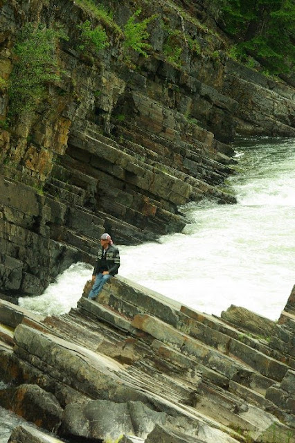
Two of us were detained and "checked out" at the border, which delayed our departure, but we were finally on our way by 10:00 a.m. It was drizzling as we left the inspection station, but we decided to put on rain jackets only because the forecast put the heavy rain south of us. So much for the weatherman. Within 30 minutes, we were experiencing constant, heavy rain. There was as much water coming up from the road as from the skies, and visibility was very poor. To make matters worse, Obama (and the Secret Service) were in town, there was a huge demonstration at the summit in Toronto, and highways and roads were closed, all to make our lives more difficult. After a few hours in heavy rain, we stopped at Barrie for lunch, the skies began to clear, the rain gear came off, and we continued to Sudbury. The highway between Barrie and Sudbury just got better as we went. It is a two lane highway which often runs between rock walls on both sides, and often in the center divider. The walls are black and brown, with marbling of reds and whites, all twisted and contorted from the ages. We found out later that the rocks were nickel and copper, the major industry in Sudbury. People had stacked rocks in many areas, looking like stone sculptures and even Japanese lanterns. The area is very rocky, covered by forests, lakes and marshlands. We saw a bunch of critters, including another swamp donkey and a large elk feeding a couple hundred yards to our ride.
 
Other than the linkage of one bike disconnecting, and the rain early in the day, another great ride.

Friday, June 25, 2010

Niagara Falls

Day: 38
Destination: Niagara Falls, New York
Route: Highway 3 to 104 west, then Lake Ontario Parkway, then 104 to Niagara Falls, NY
Miles Ridden: 330  Total Miles: 8,474

Points of Interest:
  • Dar's Cafe, Natural Bridge, New York
  • Marshland east of Natural Bridge
  • Lake Ontario, New York
  • Lake Ontario Parkway
  • Niagara Falls
After two days of rain, it was a pleasure waking up to clear skies and a promise of a rain free day. We were up and gone by 8:00 a.m., and heading west to an unknown destination. We didn't know if we would make Canada today, and hadn't decided where to cross the border. We stopped at Dar's Cafe in Natural Bridge, New York, an outstanding place for breakfast with its 25 cent coffee and $3.00 breakfasts. The people there were outstanding, and we had a great time. We decided to go to Niagara Falls, if we could make it that far on the two lane, country roads. The road was excellent (and dry), and we enjoyed our travels along the country roads through small communities, farmlands, marshlands, and lake fronts. We arrived at Niagara Falls after a 10 hour ride and checked into the local Comfort Inn. The person at the counter was very cooperative and nice and, for the first time, it appeared that rooms were becoming rather scarce. That was a rarity, even though we had stayed at some tourist popular locations. We had dinner at the Old Falls Bar & Grill and had a couple great, inexpensive martinis and decided to call it a night. Tomorrow...Canada.