The Five Corners Run 2010

This year, we will be traveling along the borders of the United States; from southern California to Brownsville, Texas- to Key West, Florida to the northern border of Maine- across the Great Lakes into Canada, to northwestern Washington, and finally back home.

12,000 miles - 30 states - 3 countries.

We call our little jaunt the Five Corners Run…

___________________________________________________________

"Life's journey is not to arrive at the grave safely, in a well preserved body, but rather to skid in sideways, totally worn out, shouting 'Holy shit, what a ride!'"

~ Mavis Leyrer
___________________________________________________________

Wednesday, July 14, 2010

Mendocino

Day: 57
Destination: Mendocino, California
Route: 101 South to Leggett, CA; Highway 1 South
Miles Ridden: 150    Total Miles: 12,726

Points of Interest:
  • Avenue of the Giants
  • Mendocino, California
  • Patterson's Restaurant

With only 150 miles to ride from Eureka and Mendocino, we relaxed a little, and didn't leave until 10:00 a.m. A little chilly, but clear, we put on our jackets and started heading south. Our goal was ride the Avenue of Giants, just south of Eureka. If you haven't taken this ride, it is a must for anyone in the area. The Avenue runs for several miles, and runs parallel with Highway 101. There are seven exits and entrances off of 101 to the Avenue, so you can ride all or part of the Avenue. The Avenue runs through several small communities, and past yet another sign of better economic times. We passed a very large lumber mill which, like the eight in Montana, employed hundreds but were shut down by the environmentalists. We passed through several stands of the most beautiful, enormous redwood trees imaginable. The tallest and oldest living thing on earth is in one of the groves of trees, although which tree has never been publicly disclosed. We stopped a few times, and found an enormous field of clover amongst the redwoods. Fantastic experience of which you just cannot grow tired.
 
Through the Avenue, we jumped on Highway 101. Forty miles later, we made the turn onto Highway 1 at Leggett. This 35 miles or so of twisted, rolling hills, with numerous 10 and 15 mph turns, also runs through the redwoods and is a great run. Eventually, you pass a sign which says "Shoreline Highway." You think the road will straighten, but noooo. More twisties as you make your way to Fort Bragg and, a mere 10 or so miles later, Mendocino. Today remained cool, and fingers of fog extended into the forests and surrounded many of the coves and inlets. Pretty much everything had a gray overcast, but the Pacific Ocean was beautiful, and the ride great. Mendocino is a very small, tourist community loaded with beds and breakfast, restaurants, and a handful of bars. We found a small, local establishment, had a very nice meal, and looked forward to tomorrow's ride home.

Ahead of schedule

The guys are running two days ahead of schedule, and due to return to their starting place of Starbucks in Danville, CA on Thursday, July 15, 2010 at 3:00 P.M.!

Tuesday, July 13, 2010

Trinidad and Eureka

Day: 56
Destination: Trinidad, then Eureka, California
Miles Ridden: 204 Total Miles: 12,576
Route: Highway 101 South
Points of Interest:
  • Scenic view from Port Orford
  • State and federal forests and parks to the Oregon border
  • National Redwood Park, California
  • Trinidad wharf

We were on the road at 8:30 a.m. today on our way to Trinidad, California. It was clear and sunny, but we could see fog to our north, and the forecast was for cooler weather, fog, and 35 mph winds from the north. On came the jackets, and we began our journey. It became apparent, however, that jackets alone would not be enough. Within a couple miles, we began hitting fog banks stretching across the highway. Each time, the temperature would drop dramatically, only to rise again when we hit sunshine rather than fog. We stopped at Port Orford, a small town, for fuel. When we began to leave, we saw a painted sign on the pavement of a side street, pointing in the direction of the "Ocean View." We took the road and found a tiled bench setting high on a bluff above a cove and beach below.


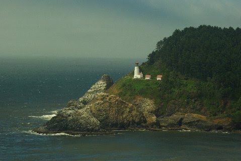
The Oregon coastline is beautiful, but it is very rugged and rocky. We were told that whales were visible from this vantage the day before, but today we did not see any whales, although the view was great. We took a few pictures, and we were off again. We rode through the redwoods of California. Not our first time, but the giant redwoods are always impressive.


We arrived at Trinidad, which is a very small town 20 miles north of Eureka. The small road curls west from the freeway, and makes its way down the hillside to the ocean and cove. We ate at a great restaurant at the end of the road, and took in the great view. We then made our way to Eureka, a much larger town, with the problems you would expect to find in any larger city. We found the Red Lion, had a snack while watching the All Star game, and settled in for the evening.

Monday, July 12, 2010

Bandon (Day 2)

Day: 55

Destination: Bandon, Oregon (Day 2)
Miles Ridden: 10    Total Miles: 12,372

Points of Interest:
  • Bandon golf resort (Old MacDonald Golf Links course)
  • The Loft Restaurant

Proving once again that you can do it all, we played golf today at the Old MacDonald Golf Links, the newest of the four courses at the resort.

As we rode to the course, the fog began pulling away. The skies were crystal blue and without a cloud in the sky. The course began to warm, but very strong winds coming off the Pacific kept the temperature in the high 60's. The strong and constant winds made the game interesting, but we had a great time. Later, we met for dinner at the Loft in Old Town. The dinner and service was excellent, and I would recommend it to anyone who may visit Bandon.

Sunday, July 11, 2010

Bandon

Day: 54
Destination: Bandon, Oregon
Route: Highway 5 south; 99 south; 240 west; forest service road between Carlton and Beaver; south on 101
Miles Ridden: 284     Total Miles: 12,362

Points of Interest:
  • Forest service road over the Coast Ranges
  • Bald Peak State Park
  • Suislaw National Forest
  • Numerous coastal state parks
  • Sea Lion Caves
  • Oregon Dunes National Recreation Area
  • Old Town Bandon, Oregon 

Another beautiful day for a ride. We rode out of Portland, and began heading southwest towards the Pacific Coast. For the first 50 miles, we rode over the Coastal Ranges on single and two lane roads, through forests and over bridges, reaching summits which looked into the valleys below. Due to the hour of the day, we hit areas brightly lit from the sun, other areas shrouded in shade so that the roadway was barely visible. At one point, a deer suddenly ran across the road about 20 feet in front of Bud's bike. Moose, Elk, Antelope and Deer...they all like to run in front of or alongside Bud. The ride over the range was rather slow, but we ultimately reached Highway 101, and turned south towards Bandon. The coast was much colder than inland, and jackets became a necessity. We began to hit areas covered with fog, which made for some nice photo opportunities. We arrived at Bandon about 5:30 p.m.

Bandon is a nice little town best known for its port in Old Town, and the Bandon Dunes golf resort to the north. We were there for both. Old Town, as it is called, has several nice shops and numerous good restaurants. We choose one, had dinner, and then settled in for the night.

Saturday, July 10, 2010

Portland

Day: 53
Destination: Portland, Oregon
Route: Highway 101 south; Highway 4 south to 401; Astoria Bridge to Astoria; Highway 30 to Portland
Miles Ridden: 211   Total Miles: 12,073

Points of Interest:
  • Grays Harbor
  • Willapa Bay
  • Lewis and Clark Trail, Park
  • Astoria, Oregon

As we left Aberdeen, driving through the small towns on our way to Portland, we drove past homes, businesses, buildings, factories and docks evidencing former prosperity, but now providing further evidence of a collapsing American economy. It was sad to see, but an unfortunate confirmation of what most Americans already know.

Once we got through these towns, we began our ride south through forests and state parks. The ride was very nice. There were several reminders that this route was first discovered by Lewis and Clark during their famous exploration between Missouri and the Oregon coastline. As we rounded the bend approaching the Pacific, we could see the Astoria Bridge, which spans Chinook with Astoria. It is a long, old bridge which, at its southern end, rises high above the city below. As you arrive in Astoria, a city founded around 1800, you see small homes built up the hillside. We saw the Flavel House Museum, built for a sea captain in 1885, and the former county jail, built in 1914. After having a great lunch, and Mikie Three Meals buying some salmon from Josephson's Smoked Fish, we rode through town on Highway 30 to Portland, Oregon. On the way, we had some great views of Mount St. Helen and Mount Hood. A nice ride. Dinner at PF Changs, a couple cocktails at Henry's downtown, and life was good.

Friday, July 9, 2010

Aberdeen

Day: 52


Destination: Aberdeen, Washington
Route: Highway 5 south to Highway 20; west on 20 to the Port Townsend Ferry; Highway 1 west, south
Miles Ridden: 288   Total Miles: 11,863

Points of Interest:
  • Deception Pass State Park
  • Port Townsend Ferry ride
  • Olympic National Park
  • Olympic National Forest

Having our primary goal accomplished after all these weeks, we began our ride home. We still have a second goal, and that was and is to ride the perimeter of the United States. We rode to the island which separates Burlington and Port Townsend, and took the ferry. This permitted us to relax for an hour while the ferry casually crossed the Strait of Juan de Fuca. The water was cold and deep, and was the bluest water I have seen. When the ferry docked, we saw the Rothschild House, a stone structure which sets high on a bluff over looking the strait. We stopped in the historic district and took a few pics. The historic district was built in the 1880's, and the stone and brick buildings were beautiful. We enjoyed a great meal of clam chowder and crab cakes, and feeling pretty good but struggling to stay awake, we headed towards Highway 101, Port Angeles, and towards the national park and forest.
 
The ride through the forest, with glimpses of the strait and other waterways, was absolutely beautiful. The traffic was light for the most part, and the road was in great condition. The best way to describe the road is rolling with twisties through the park, and with high speed twisties on the south end of the park. A rather long day, but a great day! And...one day closer to home and our loved ones.