We have ridden the border of most of the United States, and now a portion of central Canada. The economy seems to be on everyone's mind, and everyone seems more than happy to talk about the poor economy. From what we have seen, there is plenty of evidence that our economy is on the verge of imploding. It was common to ride through cities and towns, and see commercial buildings and homes abandoned. Most factories we saw were closed with empty parking lots. Throughout the northeast, for instance, the only real visible industry still in operation were small lumber mills. Car dealers were closed. Restaurants were closed. Gas stations were closed. We were looking at what once were thriving commercial communities now beginning to decompose. Our government's only "cure" for this national crisis is simply to increase spending, print more money, and increase taxes. The "tax and spend" policy of the Obama administration is blatant, and the administration is more than willing to lie to the people. The fact is that this tax and spend policy will ultimately affect the poor more than the wealthy, even though all will be affected.
We spoke to many people who were directly or indirectly connected to the tourist trade throughout the United States. Everyone we spoke to commented on the collapse of tourism, and the economic effect of this failing industry. No one, not a single person, had a positive word on the subject. In fact, while we were in Niagara Falls, New York, I spoke to a young Black woman at the hotel's front counter. I noticed she was wearing a visor with the word "Obama" printed in white. I pointed to the hat and asked whether she had voted for Obama. She immediately covered the name with both hands, said she did, and apologized. Possibly more notable, however, was her statement that someone had given her "hell" about the hat just the day before.
At this point in time, however, we are lucky. That's right, lucky. While in Canada, seemingly everyone wanted to talk about the lack of jobs and their failing economy. While traveling to Thunder Bay, we stopped at a restaurant for lunch. We spoke to the owner, a very pleasant woman whose brother lives in the United States. She was quick to complain about the Canadian government's decision to increase taxes, how the increased taxes was killing tourism and her business, and how the government had "lied" to the people. Like in the United States, so called temporary taxes became permanent, and only increased over time. In order to finance their "free" health care, Canada just increased the sales tax from 10% to 13% (effective July 1). There are other taxes, so that the cost of Canadian products is now out of reach to many. We had avoided purchasing anything in Canada, since the cost of most products was 25-50% higher than in the US. "Sin" products, such as alcohol, cigars, etc., were at least 50% higher, all to fund the "free" health care. She said she currently is paying over $5,500 in property taxes on her home, set to be increased by another $158 this year. She stated that her home is only appraised at $150,000, about four times the property taxes paid in California. The high taxes did not do anything to help her or other business people. Instead, it dramatically increased the cost of Canadian products, caused the loss of jobs, and prevented an economic environment conducive to economic growth and new jobs. Canada is already suffering from a "tax and spend" environment. Obama is bringing this disaster to us.
Tuesday, June 29, 2010


Monday, June 28, 2010
White River
Day: 41
Destination: White River, Ontario
Route: Highway 17
Miles Ridden: 214 Total Miles: 9,199
Points of Interest:


Today was the coldest day of our trip. Although we did not have any rain, we put on everything we could to keep warm...sweatshirts, jackets, rain jackets...but it was still cold. We also had more wind than we had experienced, with gusts up to 45 miles per hour. We left at 9:30 a.m., and arrived at White River at 4:00 p.m. We took several opportunities to stop and look around at things, and to take a few pictures. We left Lake Huron, and early on we began running alongside Lake Superior. Even with the overcast and grey skies (it looked like it was going to pour the entire day), the views over the lake were fantastic. In some areas, white beaches could be seen, as well as small islands. Larger islands were seen in the distance, as clouds hung low over the mountains around the lake. At the higher elevations, the highway was engulfed in a dense fog making visibility difficult at times, and the riding even colder.
We exited the highway, and road down a single lane road to Sinclair Cove. There was a boat ramp, with a pickup truck backed up to the water. Two American Indians, part of the Agawa Tribe, were cleaning about 500 pounds of whitefish which they caught that morning using gill nets. Gill nets are outlawed in the US and Canada, but can be used by Native Americans. We took a few photos (until the battery died), and moved on. We stopped for lunch at Wawa at a restaurant called the Viking. The chicken pot pie was excellent, and after a break, we continued on our way to White River. White River is little more than a bump in the highway (Not even available to mark on our blog's pin map). It had two hotels and one restaurant. We settled in for the night.
Destination: White River, Ontario
Route: Highway 17
Miles Ridden: 214 Total Miles: 9,199
Points of Interest:
- Lake Superior
- Agawa Indian Gift Store
- Lake Superior Provincial Park
- Sinclair Cove
- City of Wawa
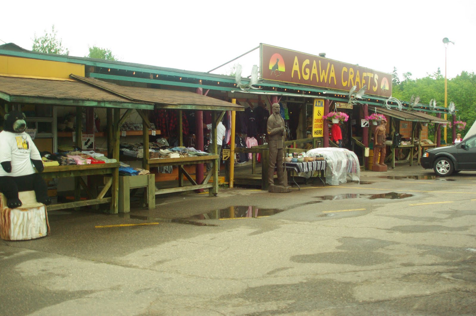

Today was the coldest day of our trip. Although we did not have any rain, we put on everything we could to keep warm...sweatshirts, jackets, rain jackets...but it was still cold. We also had more wind than we had experienced, with gusts up to 45 miles per hour. We left at 9:30 a.m., and arrived at White River at 4:00 p.m. We took several opportunities to stop and look around at things, and to take a few pictures. We left Lake Huron, and early on we began running alongside Lake Superior. Even with the overcast and grey skies (it looked like it was going to pour the entire day), the views over the lake were fantastic. In some areas, white beaches could be seen, as well as small islands. Larger islands were seen in the distance, as clouds hung low over the mountains around the lake. At the higher elevations, the highway was engulfed in a dense fog making visibility difficult at times, and the riding even colder.
We exited the highway, and road down a single lane road to Sinclair Cove. There was a boat ramp, with a pickup truck backed up to the water. Two American Indians, part of the Agawa Tribe, were cleaning about 500 pounds of whitefish which they caught that morning using gill nets. Gill nets are outlawed in the US and Canada, but can be used by Native Americans. We took a few photos (until the battery died), and moved on. We stopped for lunch at Wawa at a restaurant called the Viking. The chicken pot pie was excellent, and after a break, we continued on our way to White River. White River is little more than a bump in the highway (Not even available to mark on our blog's pin map). It had two hotels and one restaurant. We settled in for the night.
Sunday, June 27, 2010
Sault Ste. Marie
Day: 40
Destination: Sault Ste. Marie, Ontario
Route: Highway 17
Miles Ridden: 190 Total Miles: 8,950
Points of Interest:

Destination: Sault Ste. Marie, Ontario
Route: Highway 17
Miles Ridden: 190 Total Miles: 8,950
Points of Interest:
- Lake Huron
- Lakes, marshes, streams
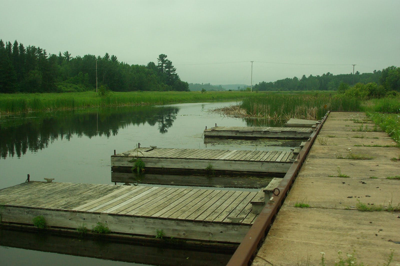
A 190 mile ride on a two lane road, rain (heavy at times), wind...another perfect day to ride!
The road between Sudbury and Sault Ste. Marie is a beautiful road. Two lanes which meander through and over mountains of forests, lakes, lagoons, rivers and marshland. The lakes were all black bottomed, mostly consumed by water plants which rose above the water leaving the elusion that streams were cutting back and forth, snaking through the plants. Everything was green. As we were riding, we had to look out for the wildlife (which we didn't see today), and had to be particularly careful due to the rain and wind. Sault Ste. Marie was not much to see. An older town, with older hotels, with few restaurants in the area. It is one of those cities where nothing seems close to anything else. We ended up eating pizza at the pub next to the hotel. Great pizza, but the pub lacked a little in ambience.
Saturday, June 26, 2010
Sudbury
Day: 39
Destination: Sudbury, Ontario, Canada
Route: Highway 190 across the international line; Highway 400 through Toronto; Highway 69 through Barrie and Parry Sound
Miles Ridden: 321 Total Miles: 8,795


Destination: Sudbury, Ontario, Canada
Route: Highway 190 across the international line; Highway 400 through Toronto; Highway 69 through Barrie and Parry Sound
Miles Ridden: 321 Total Miles: 8,795
Notable Quote: Trying to explain why he didn't want to walk the 500 yards to see Niagara Falls..."What's in a forest? Trees. What's in a waterfall? Water. If you've seen one, you've seen them all." ~Mike "Hammer" Oliveira
Notable Quote: Explaining why we were wasting time in putting on our rain gear after leaving the border inspection center, 30 minutes before Noah and his ark floated by on the freeway..."I'm pretty sure we have clear weather ahead." ~Ulysses "Bud" EarlyPoints of Interest:
- Niagara Falls State Park
- Highway 69 north of Barrie, Ontario


We looked out the window this morning, and saw a wet parking lot and dark, dark skies, but it wasn't raining, so two of us walked over to the Niagara Falls State Park about 500 yards from the hotel. There is a sidewalk alongside the rushing waters which ends at the observation deck. From the observation deck, you can see the falls from the US side, literally from the edge of the falls, as well as the pool below. Three of us had seen the falls before, although not from this side. It is an amazing sight, and something you can't get tired of seeing. The roar of the water is unforgettable. 40,000,000 gallons of water per minute go over the falls, and the water falls 162 feet to the pool below. And to think that lunatics have gone over the falls in barrels!
Two of us were detained and "checked out" at the border, which delayed our departure, but we were finally on our way by 10:00 a.m. It was drizzling as we left the inspection station, but we decided to put on rain jackets only because the forecast put the heavy rain south of us. So much for the weatherman. Within 30 minutes, we were experiencing constant, heavy rain. There was as much water coming up from the road as from the skies, and visibility was very poor. To make matters worse, Obama (and the Secret Service) were in town, there was a huge demonstration at the summit in Toronto, and highways and roads were closed, all to make our lives more difficult. After a few hours in heavy rain, we stopped at Barrie for lunch, the skies began to clear, the rain gear came off, and we continued to Sudbury. The highway between Barrie and Sudbury just got better as we went. It is a two lane highway which often runs between rock walls on both sides, and often in the center divider. The walls are black and brown, with marbling of reds and whites, all twisted and contorted from the ages. We found out later that the rocks were nickel and copper, the major industry in Sudbury. People had stacked rocks in many areas, looking like stone sculptures and even Japanese lanterns. The area is very rocky, covered by forests, lakes and marshlands. We saw a bunch of critters, including another swamp donkey and a large elk feeding a couple hundred yards to our ride.
Other than the linkage of one bike disconnecting, and the rain early in the day, another great ride.
Friday, June 25, 2010
Niagara Falls
Day: 38
Destination: Niagara Falls, New York
Route: Highway 3 to 104 west, then Lake Ontario Parkway, then 104 to Niagara Falls, NY
Miles Ridden: 330 Total Miles: 8,474
Points of Interest:

 After two days of rain, it was a pleasure waking up to clear skies and a promise of a rain free day. We were up and gone by 8:00 a.m., and heading west to an unknown destination. We didn't know if we would make Canada today, and hadn't decided where to cross the border. We stopped at Dar's Cafe in Natural Bridge, New York, an outstanding place for breakfast with its 25 cent coffee and $3.00 breakfasts. The people there were outstanding, and we had a great time. We decided to go to Niagara Falls, if we could make it that far on the two lane, country roads. The road was excellent (and dry), and we enjoyed our travels along the country roads through small communities, farmlands, marshlands, and lake fronts. We arrived at Niagara Falls after a 10 hour ride and checked into the local Comfort Inn. The person at the counter was very cooperative and nice and, for the first time, it appeared that rooms were becoming rather scarce. That was a rarity, even though we had stayed at some tourist popular locations. We had dinner at the Old Falls Bar & Grill and had a couple great, inexpensive martinis and decided to call it a night. Tomorrow...Canada.
Destination: Niagara Falls, New York
Route: Highway 3 to 104 west, then Lake Ontario Parkway, then 104 to Niagara Falls, NY
Miles Ridden: 330 Total Miles: 8,474
Points of Interest:
- Dar's Cafe, Natural Bridge, New York
- Marshland east of Natural Bridge
- Lake Ontario, New York
- Lake Ontario Parkway
- Niagara Falls


Thursday, June 24, 2010
Tupper Lake
Day: 37
Destination: Tupper Lake, upstate New York
Route: Highway 89, south on Highway 7, Essex Ferry, Highway 9N, Highway 86, Highway 3
Miles Ridden:138 Total Miles: 8,144
Points of Interest:


We began to head up into the mountains to the west. We stopped at a local restaurant in Elizabethtown, NY, and then made our way to Lake Placid. Downtown Lake Placid was very nice, and we enjoyed our brief stay. As we began to leave, however, the rain returned, this time constant and heavy. On again went the rain gear, and we continued west. By 4:00 p.m., the ride was getting too hairy. We gave up the ghost and stopped at Tupper Lake for the night.
Destination: Tupper Lake, upstate New York
Route: Highway 89, south on Highway 7, Essex Ferry, Highway 9N, Highway 86, Highway 3
Miles Ridden:138 Total Miles: 8,144
Points of Interest:
- Valleys and farmland of Vermont
- Essex Ferry to upstate New York
- Downtown Lake Placid, New York


Our day began with heavy rain. Not the best way to start the day, but at least the temperature was 72 degrees, and the rain was warm. Rain is still rain, heavy at times, and we knew we were going to have an interesting day. It was unfortunate, since we intended to take some photos of downtown Montpelier, Vermont. Many of the buildings and Inns in Montpelier date back to the 1820's. We opted not to do so, and instead we hopped on the bikes and began our ride west. When you are dealing with heavy rain, it is difficult to enjoy the scenery. We tried, and our route was beautiful, but we spent most of our time watching the road and looking out for that elusive swamp donkey. We got to the Essex Ferry and alas, the sun was breaking. Off came the rain gear, and we enjoyed the ride to upstate New York. The trip was very nice, since the water was calm and blue, the sky was blue, and fog had settled on the water on the New York side. It cleared as we got to the shore, and we disembarked onto a small, two lane highway south. The rain had recently passed over the area, and the heat from the sun caused steam to rise from the pavement. The road meandered along the coast, with small homes on both sides of the streets. Many of the homes had small docks on the water.
We began to head up into the mountains to the west. We stopped at a local restaurant in Elizabethtown, NY, and then made our way to Lake Placid. Downtown Lake Placid was very nice, and we enjoyed our brief stay. As we began to leave, however, the rain returned, this time constant and heavy. On again went the rain gear, and we continued west. By 4:00 p.m., the ride was getting too hairy. We gave up the ghost and stopped at Tupper Lake for the night.
Wednesday, June 23, 2010
Montpelier
Day: 36
Destination: Montpelier, Vermont
Route: Highway 95, to 222, then west on Highway 2
Mile Ridden: 257 Total Miles: 8,006
Points of Interest:


Destination: Montpelier, Vermont
Route: Highway 95, to 222, then west on Highway 2
Mile Ridden: 257 Total Miles: 8,006
Points of Interest:
- Mexico, Maine
- Farmland and marshland on Highway 2
- White Mountains, Maine
- Montpelier, Vermont


We woke up today with the parking lot and our bikes wet from rain. The forecast was rain in the morning, but clearing in the afternoon, but by 10:30 a.m., the rain was only increasing and clear skies did not look likely. We left by 11:00 a.m., and rode through the rain, heavy at times, for about three hours. Eventually, the rain weakened, the rain suits came off, and riding returned to "normal." Essentially, the entire day was on Highway 2, which is an east to west highway which runs from Maine, through New Hampshire, and into Vermont. Our goal was Burlington, Vermont, but with the late start, and the rain, we came up 40 miles short and spent the night in Montpelier.
It turned out to be a great choice, since Montpelier is a great town, with very old buildings and streets, and some great restaurants and an outstanding Irish Pub. Highway 2 was an outstanding road as well, which ran from the hills and valleys of Maine, to the mountains of Vermont where the road begins with a two lane road, then a four lane road cut through granite, to a 2 lane road as it wraps around and through many communities. The scenery is the best, with everything around you a lush green. There are lakes, rivers, and streams which snake through marshland. It was a very enjoyable ride, despite the rain.
Subscribe to:
Posts (Atom)